Live GIS Constituency Maps

GIS Maps

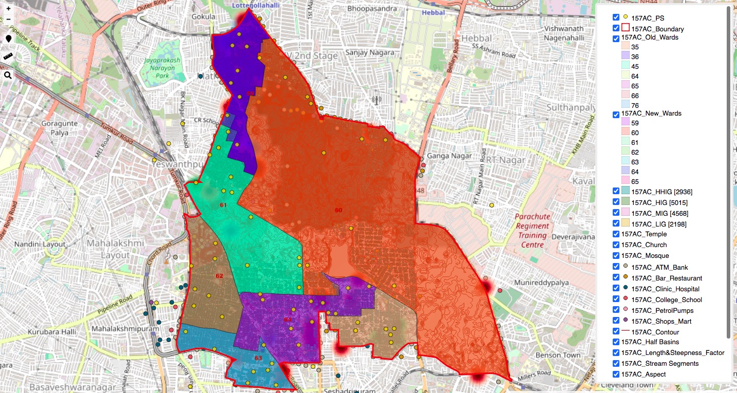
Exclusive GIS Heat Map by Smart Neta

The term geospatial (GIS-Geoghraphical Information System) refers to the location-based data that can be represented on a map. By overlaying political data onto geospatial maps, one can visualize the distribution of voters, political parties, and other key factors that influence political outcomes.

We create location based intelligence as GeoSpatial Maps of Ward  and Constituency to help you know your election turf thoroughly. It will help you draw a development plan based on a scientific research. These GIS maps allows you to discover and communicate meaningful patterns of data. Multiple data sets of constituency demography to help booth or ward level segmentation, which in turn will be easier and quicker in building strong booth level strategy. It will help you in finding the best location to make predictive analysis to optimize your ground volunteer & resources. See your database come to life with our GeoSpatial view and database filters. The data sets can be further shared as cloud based live WebGIS Constituency Maps with all relevant attributes.

1 Live map of high resolution to view smallest data on buildings, roads, footpath, parks, public amenities.
2 Both OSM & Google base map to fetch information for rural, tribal and city.
3 Live measurements tools to measure road lengths, park area, agricultural, commercial parcels, etc.
4 Heat-map of worship places like Temples, Mosque & Church to find the religion dominance.
5 Parliament, Assembly, Ward Constituency boundary with toggle layers option to view POI.
6 Classification of houses as HHIG,HIG,MIG,LIG groups to find economic density for better campaigns.
7 Live GPS locator to self find volunteer location within the canvass area.
8 Compatible with IOS, Android, Tab & Windows without any need of installation of App or software.